Exploring Waza National Park: A Biodiverse Landscape from Space
Waza National Park, Cameroon, captured by Copernicus Sentinel-2 mission, spans 1,700 sq km near the borders of Chad and Nigeria. It is a UNESCO World Heritage biosphere reserve, home to diverse wildlife. The logistics of seasonal flooding impact local agriculture and living conditions for over 100,000 residents, with notable changes in landscape observed through the year.
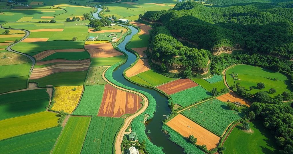
The Copernicus Sentinel-2 mission has provided striking imagery of the Waza National Park in Cameroon, capturing its remarkable surrounding landscapes. This national park is located in the northern region of Cameroon, bordering Chad to the east and Nigeria to the west, spanning an area of 1,700 square kilometers, approximately 10 kilometers from each border.
Waza National Park showcases a wealth of biodiversity, serving as the country’s most significant wildlife reserve. It is home to a variety of animals, including lions, elephants, giraffes, antelopes, and numerous bird species. Since its designation as a UNESCO World Heritage biosphere reserve in 1979, it has played a crucial role in conservation efforts.
The small town of Waza, located at the western edge, is marked as a yellowish area surrounded by lush green lands, while the expansive green region that envelops the park is identified as the Logone floodplain. This floodplain is one of several within the Lake Chad basin, nourished by seasonal flooding from the Logone River, which serves as a natural border between Cameroon and Chad.
This ecosystem undergoes significant changes, driven by distinct dry and wet seasons. The rainy season, lasting from mid-May to mid-October, transforms the region into a temporary wetland which supports various plant life, including grasses and reeds. The local population, exceeding 100,000 residents, relies heavily on these seasonal floods for their livelihoods in fishing, grazing, and agriculture.
The imagery captured in November 2024 reflects the landscape post-flooding, with vibrant green fields indicating fertility. However, the early signs of the dry season are also observable, as natural vegetation remains intact in the park while surrounding lands shift to post-harvest stubble, presenting brown tones. To the right, the Chari River flows green, merging with the Logone River before continuing to Lake Chad to the north, with N’Djamena, the capital city of Chad, visible as a grey area at the top of the image.
In summary, the Waza National Park in Cameroon is not only vital for its diverse wildlife but also plays an essential role in the local ecosystem and the livelihoods of surrounding communities. The imagery from the Copernicus Sentinel-2 mission highlights seasonal transformations in the landscape, underlining the interconnectedness of natural cycles and human activities in this unique region.
Original Source: www.esa.int


